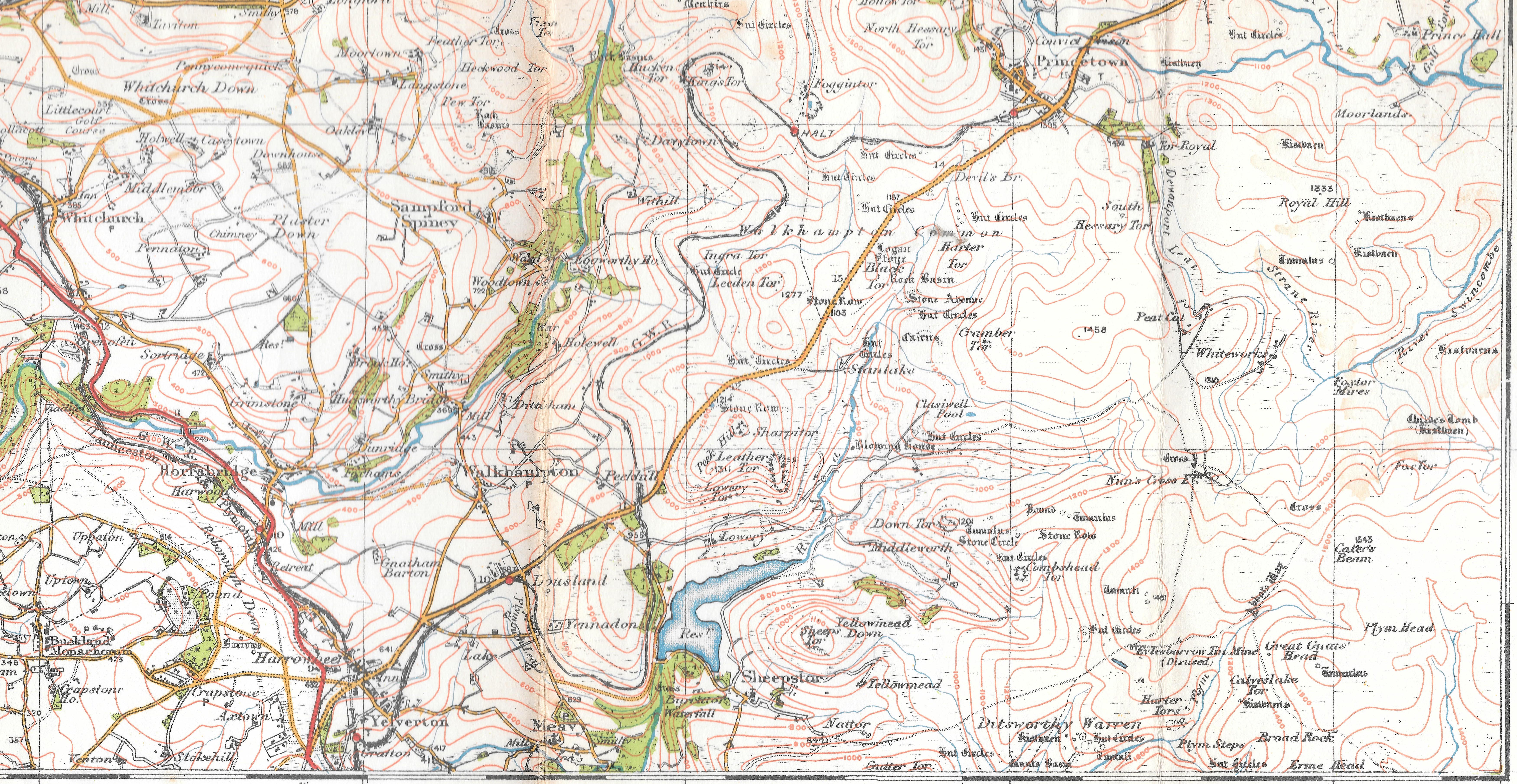
About Lowry Road Crossing
Lowery Road Crossing was located between Burrator and Ingra Tor Halts, near the 33-mile post. Originally a manned crossing, it was attended by a resident keeper until around 1927, when it was downgraded to an unmanned level crossing. At that point, warning bells were installed, operated by treadles that were triggered by approaching trains. The old ground frame was removed, and the operational distant signals were replaced with fixed ones.
Despite its change in status, the crossing keeper’s cottage remained intact and was later let out as a private residence. Once the crossing became unmanned, it was the responsibility of any approaching motorist to manually open the gates if they were closed. Drivers had to check for the sound of the warning bells before crossing the railway and were expected to close the gates after crossing.
The crossing was approached with caution by trains, whose drivers were instructed to sound their whistles when nearing the site. Speed restrictions of 10 miles per hour were imposed for any train passing over the crossing. If the warning bells were found to be faulty, the train crew had to report the issue at the next station, where arrangements would be made to ensure the crossing’s safety until repairs were completed.
While the railway eventually closed in 1956, Lowery Road Crossing and its nearby surroundings remain part of the local landscape’s historical fabric. Even after its tracks were lifted, the remnants of this once-important crossing served as a reminder of the Princetown Railway’s long service to the region.
In Brief
The remains of the crossing keeper’s cottage at Lowery Level Crossing and an adjacent outbuilding stand as mere echoes of their former existence. The cottage, razed to rubble sometime post-1962, and the outbuilding, meeting a similar fate prior to that year, leave behind only faint imprints on the landscape. What remains of the cottage manifests as a T-shaped portion of wall footing, extending approximately 4.8 meters eastward from the Princetown Branch track bed. Its north-south span, measuring at least 6.2 meters (possibly up to 7.9 meters), features a cross wall extending roughly 3.7 meters on the eastern side. Nearby, a faint outline suggests the presence of another small segment of footing, aligned parallel to the longer wall.
The scant remnants of the outbuilding lie approximately 3.7 meters east of the cottage site, discernible only by three faint earthwork sides indicating the former positions of the north, east, and west walls. These earthworks cover an area spanning at least 1.5 meters north to south and approximately 3 meters east to west. Both structures were originally depicted as stone-built on the first edition Ordnance Survey map, with the cottage running parallel to the railway line and the outbuilding aligned east-west.
A second stone-built building, adjoining the northeast corner of the first, is depicted in ruins on the second edition Ordnance Survey map, yet no visible traces of it remain above ground. Across the track bed, where once stood a wood and/or iron signal box dating back to the 1880s, and an adjacent smaller building from 1904 or earlier, now lies only a narrow green verge. It’s speculated that a platelayers’ hut, mentioned by A.R. Kingdom in 1991, may have occupied the space of the vanished structures on later maps.
Formerly part of Lowery Farm, the triangular site housing the cottage, outbuildings, and later additions like the signal box, once formed the northeast corner of a field known as Three Corners. Recorded as field 773 in the 1839 tithe apportionment, its transformation began with the advent of the railway.
Today, the site is largely reclaimed by grass, with only the faintest vestiges of stone footings hinting at its former occupation. Though the grassy plateau where the structures once stood remains uneven, it’s now free from encroaching bracken, preserving a subtle memory of its past.
image follows